
Gadeokdo doesn’t feel like part of Busan when you’re standing on it. Technically it’s the city’s westernmost and southernmost point, but it’s an island connected by bridge, set between the container terminals of the new port and the open sea toward Geoje. Gamnaetgil Course 5-3 loops around its coastline, and everyone who’d done it warned us it was the longest and toughest section of Gamnaetgil’s fifth course. I’ve now walked it twice: first in mid-October with my friend Junho, saved for a clear autumn weekend, and again in early December with a different friend, Seoyeon, who had heard me talk about the sea cave, the goats and the ridge views often enough that she wanted to see them herself.
Route order
October with Junho: the full loop
Getting there from Hadan
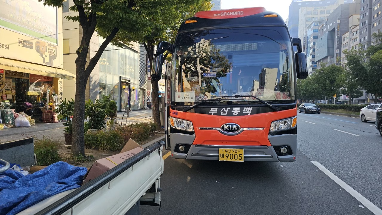
We cut through the underground passage near Hadan Station to reach the meeting point, one of those long, quiet subway walkways Busan has plenty of, lined that day with a small photo exhibition. Public transport to Gadeokdo itself is limited, so we did what most walking groups do and booked seats on a chartered bus. It’s a short ride from there, maybe twenty minutes, across the bridge and into Jiyanggok, the small parking lot turned trailhead where the walking starts.
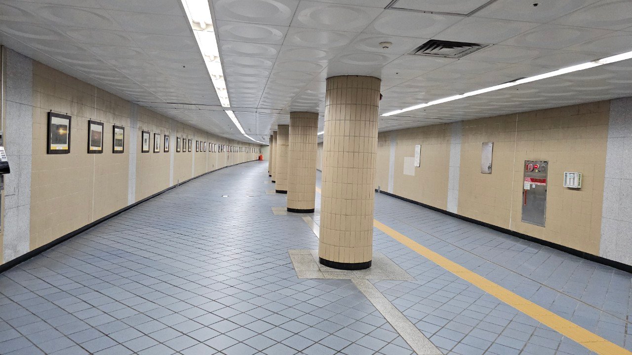
The underground passage near Hadan Station, our meeting point before the ride to Gadeokdo.
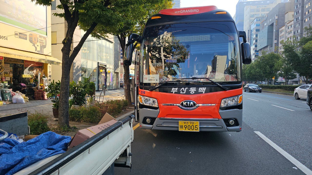
Our ride to Gadeokdo: a chartered bus, since public transit to the island is limited.
Old roads and cosmos flowers
The first stretch follows Gadeokdo’s old coastal road, now mostly bypassed by a newer route inland, so it’s quiet and a little overgrown. Cosmos flowers were blooming along the shoulder the whole way. Some sections have no sidewalk at all, just a single-file line of hikers hugging the guardrail, so this isn’t a course to zone out on.
We reached Daehang village, a small fishing settlement, and turned toward Daehang Saebaji, a pebble beach becoming known for its cafés. A couple of new ones have opened in the last year or two, according to a friend of a friend who runs one of them. From there, Yeondaebong peak comes into view ahead, and that’s when the coastal walk turns into a real hike.
The climb, the sea cave and Huimangjeong
The trail from Daehang Saebaji up toward the ridge starts with a set of stairs and doesn’t let up for a while. This is the part of Course 5-3 that earns its reputation. About halfway up there’s a small sea cave that we’re told was once used as shelter from sudden rain. On the day we passed, a couple of goats had taken it over, which made for a good laugh and a good photo.
We’d planned to rest at Huimangjeong pavilion, but it was closed off that day, so check ahead if it’s part of your plan. Instead we took a short break on a nearby deck, near the site of an old military barracks. Someone had built a small stone cairn there, and we added a rock each, more out of habit than superstition.
Eumeumpo and Nureungneung
Eumeumpo, a few kilometers further, is named for the sound fish reportedly made in the water here, “eumeum” meaning something like a fish’s cry. It’s easy to see why people once settled this cove: a small stream feeds it, there’s fresh water, and it’s sheltered from the open sea. What’s left now are old house foundations and one particularly photogenic bend in the trail. We ate lunch on a wooden platform that had clearly once been someone’s porch.
Past Eumeumpo the path climbs again toward Nureungneung, named for the yellowish rocks along this stretch of coast. A recent typhoon had washed away soil here and left mostly loose stone, so this section needs careful footing even on a dry day. From the ridge above Nureungneung the views stretch back toward Daehang Saebaji and out to the open water, and on the way down we spotted a deer moving through the brush.
Village roads, oyster farms and the finish at Cheonga Bridge
The trail eases after the ridge, dropping into a rural stretch with persimmon trees heavy with fruit, passion flowers, a carefully tended pomegranate tree and a fragrant osmanthus in full bloom. Its scent apparently carries for miles, which is where the flower gets its Korean nickname. This is Gadeokdo at its most relaxed: quiet lanes, oyster seed farms along Dongseon breakwater, and views across to Nulcha Island and the new port’s cranes in the distance.
We passed a protected old tree at Naenul village, waved back at a bus driver who waved first, and eventually crossed Cheonga Bridge to the finish, the same bridge that connects Gadeokdo back to the mainland. By the time we stamped our trail books, we both agreed the “toughest section” reputation was earned, and so was the payoff.
Walked in mid-October under clear skies, a few weeks after a typhoon had passed through, which explains the trail damage mentioned above. Distance and timing are from our own GPS track that day.
December with Seoyeon: the same loop in winter
December on Gadeokdo is a different animal. The wind off the strait doesn’t let up, and by the time we reached the trailhead the temperature had clearly dropped since we’d left the mainland. Walking it a second time, I noticed how differently a place reads depending on the season. The ridge that felt lush and green in October had a stripped-back, golden-brown look, dry grass catching the low winter light instead of hiding it.
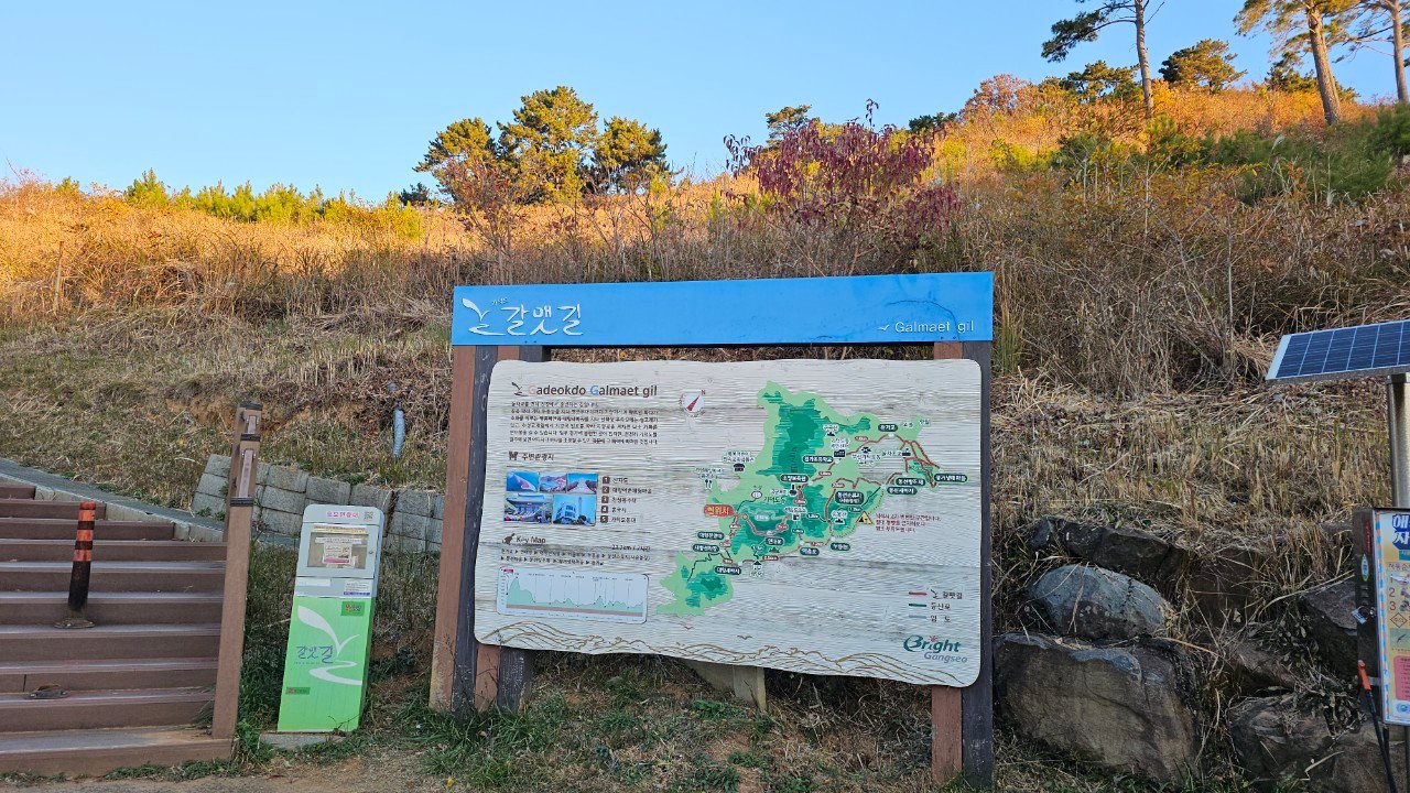
The official Gadeokdo Gamnaetgil trail map, posted near one of the trailheads.
Same route, different light
We followed the same loop: Jiyanggok, Daehang village, the climb toward Yeondaebong ridge, Eumeumpo, Nureungneung, and down through the village roads to Cheonga Bridge. The difference was how empty it felt. October had cosmos flowers and a handful of other hikers. December had almost nobody, just us, the wind and long views across water gone a deep winter blue.
From the higher points on the ridge, the view opens toward Geoga Bridge in the distance, its cable-stayed towers catching the last of the afternoon light along with the port facilities below. The scale of the water and the mountains behind it is bigger in person than a photo shows.
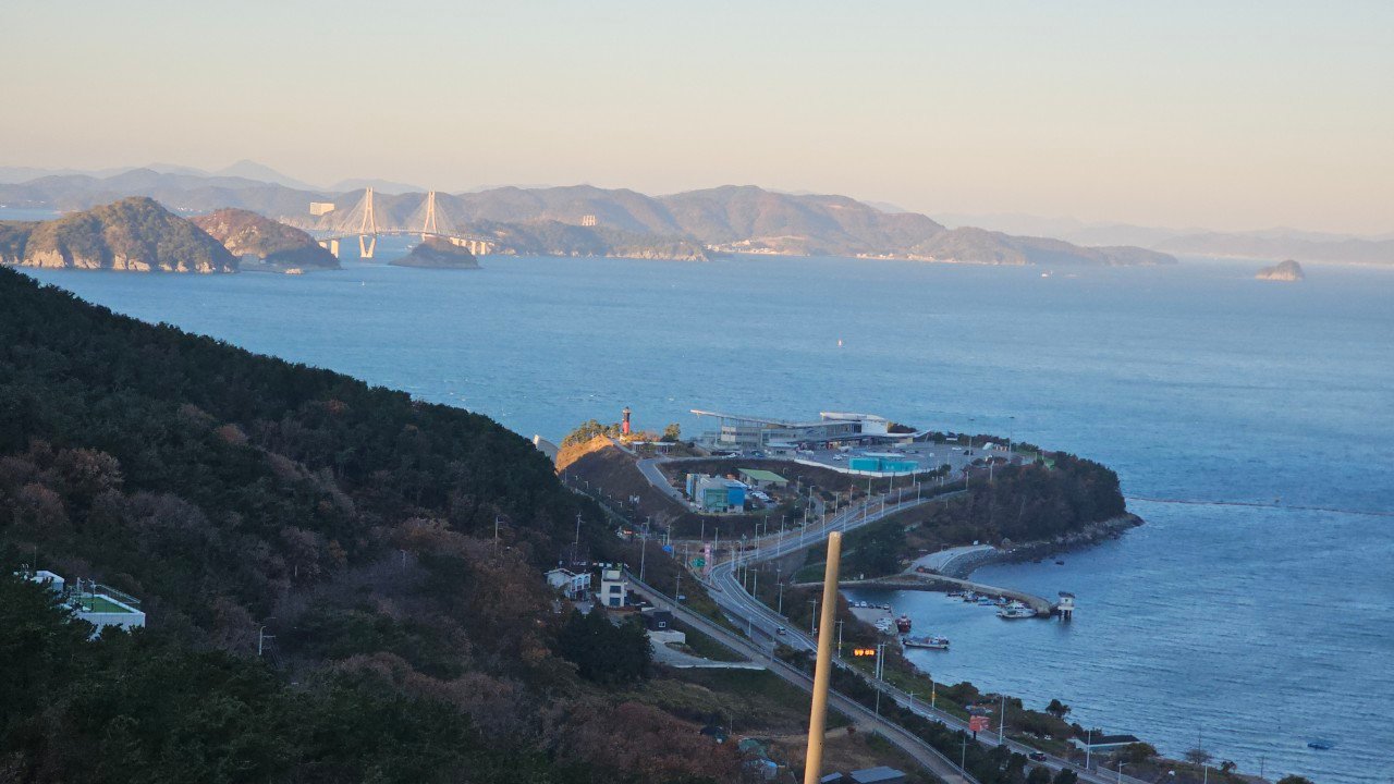
Looking out toward Geoga Bridge from the ridge above Daehang.
What winter changes
The wind on the exposed ridge sections is much stronger than in autumn. We both wore more layers than we thought we’d need and were glad of it. Daylight is shorter too, so a course that took about five hours in October needs an earlier start in December if you want to avoid finishing in the dark. The upside is the quiet: on a winter weekday Gadeokdo has almost none of the crowds you’ll find here in spring or autumn.
Winter walking tips
We finished at Cheonga Bridge again, cold but glad we’d come back. Some trails are worth walking once. This one, I’ve decided, is worth walking in every season.
Walked in early December, cold and windy with clear visibility, a very different day from our first time on this course in October.
Trail info at a glance
- Distance: approx. 13-15 km (our October GPS track; trackers vary slightly on this one), about 13 km on the December walk
- Walking time: 5-5.5 hours including breaks in October; 5+ hours in winter, when shorter daylight and stronger wind call for extra time
- Difficulty: Moderate to hard: a real climb up to Yeondaebong ridge and loose stone sections near Nureungneung, colder and windier in winter
- Start: Jiyanggok, Gadeokdo (best reached by chartered bus or tour van from the Hadan area, about twenty minutes; public transit is limited)
- Finish: Cheonga Bridge
- Best season: Autumn for cosmos and cooler climbing weather; winter for quiet, with an earlier start. Avoid peak summer heat on the exposed ridge sections
Map of the route
Course 5-3 loop
A few practical notes
Because public transport to Gadeokdo is limited, look for a group tour bus (several Busan walking clubs organize weekend trips like this) or plan to use your own car. Relying on public buses alone makes the logistics much harder.
Bring more water than you think you’ll need. Once you’re on the ridge section between Daehang Saebaji and Eumeumpo there’s nowhere to refill until the village roads near the end. Good footwear matters more here than on most Gamnaetgil sections, since the storm-damaged stretch near Nureungneung is loose underfoot. Check ahead whether Huimangjeong pavilion is open if you plan to rest there.
In winter, layer up more than you think you need: the ridge sections are directly exposed to sea wind with no windbreak. Bring a headlamp, or at least know your finish time, if you’re starting later than mid-morning, since December sunsets in Busan come earlier than visitors expect.
If you’re planning a wider Busan trip around Gadeokdo and the western coast, our guide to getting around Busan is a good starting point for the transit basics. If winter walking is what you’re after, our walking club’s graduation trip that same season went further afield: see A Winter Trip to Wondae-ri Birch Forest, Inje.
We later climbed Yeondaebong again from the opposite side of the island. See our Section 5-2 write-up from the Sinho side for a very different approach to the same summit.
What This Page Does Not Cover
This page reflects our own research and, where noted, our own visits, on Gadeokdo Island Loop on Gamnaetgil Course 5-3: Autumn and Winter at the time of writing. It does not show every option available, it does not track prices (these change too often to keep accurate here), and it cannot account for individual mobility, budget, or seasonal closures on the day you travel.
What Should You Know Before You Go?
See the sections above for the specifics on Gadeokdo Island Loop on Gamnaetgil Course 5-3: Autumn and Winter; this page is meant as a starting point, not the final word. Confirm current hours and conditions directly before you travel.
More walks nearby
Other walks in Nakdong River, Gangseo and Gadeokdo on this site: